I just accidentally got this post https://www.facebook.com/photo/?fbid=806790682470208&set=a.131430673339549 that I find very informative, so I will post it here as well (although in my country we do not have two words for gulf and bay, for cape and peninsula, its the same meaning here, I also noticed some people also asked about that):
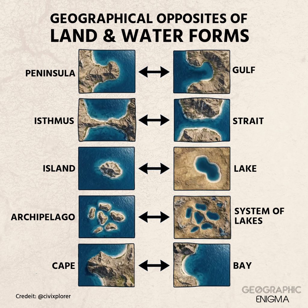
Did you know that landforms have aquatic counterparts?
This concept of “geographical duality” reveals how land and water often act as positive and negative spaces, mirroring each other’s structures. This visual logic, rooted in Montessori education, helps us understand that an island—land completely surrounded by water—is the structural inverse of a lake, which is water entirely enclosed by land.
The most impactful pairing is arguably the isthmus and the strait. While an isthmus like the one in ![]() Panama connects landmasses but blocks naval travel, a strait connects oceans but creates narrow “chokepoints” for global trade. Throughout history, humans have even carved artificial straits through isthmuses, such as the Suez canal in
Panama connects landmasses but blocks naval travel, a strait connects oceans but creates narrow “chokepoints” for global trade. Throughout history, humans have even carved artificial straits through isthmuses, such as the Suez canal in ![]() Egypt, to “fix” geography for commerce and navigation.
Egypt, to “fix” geography for commerce and navigation.
These patterns are often the result of identical geological forces. Glacial action in ![]() Finland created a vast system of lakes, while similar carving in
Finland created a vast system of lakes, while similar carving in ![]() Greece or
Greece or ![]() Norway resulted in sprawling archipelagos and deep gulfs. Whether it is a peninsula extending outward or a gulf carving inward, the boundary is often just a matter of changing sea levels.
Norway resulted in sprawling archipelagos and deep gulfs. Whether it is a peninsula extending outward or a gulf carving inward, the boundary is often just a matter of changing sea levels.